
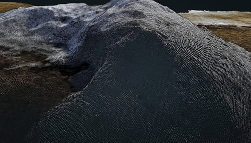
Point clouds for volume calculation
Volume calculation by drone
I carry out drone-based volume calculations. Compared with volume surveys done with traditional GNSS (GPS) equipment, which tend to be slow with varying accuracy, a drone survey is quick to carry out and highly accurate. Photogrammetry produces a very large number of points cost-effectively, so the point-cloud accuracy is top-class. I recommend volume calculation for example when selling aggregates — you get precise information about how much gravel or other material there is in a given location, which makes selling it easier.
Construction-site monitoring
Depending on the area, drone mapping can be carried out very quickly, especially on construction sites — typically in the early phases of a project. Compared with a total station, GNSS methods or a terrestrial laser scanner, producing a point cloud by drone is much faster. The point cloud can be georeferenced to a coordinate system or produced to scale. Scaled point-cloud data works well for volume calculation and general inspection of the area — for example for tracking site progress.
Mapping housing-company buildings
For housing companies I can produce point-cloud data of the façades and roof areas, also as a mesh. The mesh makes the required maintenance work easy to spot. The survey is done with a combination of a system camera and a drone, so individual details can also be inspected from the photographs. Once the images form a three-dimensional model, you can also examine for example how water flows across the yard area.
 EN
EN FI
FI ES
ES